
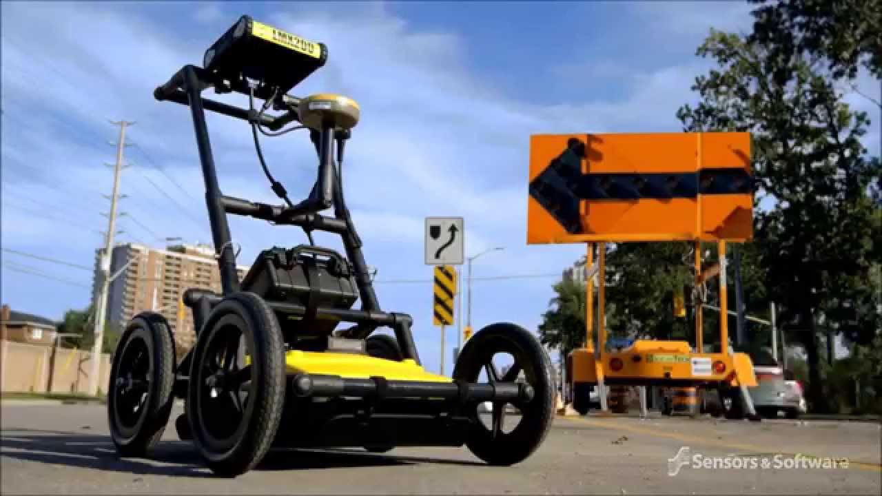
We often get asked, what is the Sensors & Software LMX200? It is a professional-grade Ground Penetrating Radar (GPR) unit designed to locate and map buried utilities that traditional electromagnetic locators cannot find. By sending radio frequency pulses into the ground and measuring the reflections, it identifies both metallic and non-metallic assets, such as plastic pipes, concrete conduits, and storage tanks. Consequently, it is the industry standard for Subsurface Utility Engineering (SUE) in Australia. This system provides real-time data visualisation on-site, allowing field teams to make informed decisions and prevent costly utility strikes during excavation.
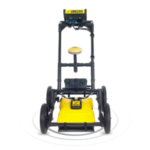 Why Subsurface Mapping Matters in Australia
Accurate underground mapping is a critical safety requirement for any Australian construction or civil engineering project. As our urban environments become more congested, the risk of hitting a “hidden” utility increases. According to Before You Dig Australia (BYDA), utility strikes can lead to massive financial penalties, project delays, and significant safety hazards for workers.
Furthermore, traditional cable locators rely on electromagnetic signals, which means they are only effective on conductive materials like copper or steel. However, many modern Australian assets are made of PVC, poly, or fibre optics. The Sensors & Software LMX200 fills this vital gap. It allows contractors to achieve AS 5488.1:2019 compliance by providing a non-destructive way to verify the location of all utility types before a single shovel hits the dirt.
 Defining GPR and Ultra-Wideband Technology
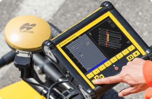
To understand the power of the Sensors & Software LMX200, one must understand Ground Penetrating Radar (GPR) physics. GPR works by emitting a pulse of energy into the soil. When this pulse hits an object with different electrical properties (like a pipe or a void), a portion of the energy reflects back to the receiver.
The LMX200 utilizes a 250 MHz ultra-wideband (UWB) antenna. This frequency is specifically chosen because it offers the “sweet spot” for utility locating. It provides enough depth penetration to find deeply buried sewer lines while maintaining enough resolution to detect smaller telecommunication conduits. Therefore, users get the best of both worlds: clarity and depth. In addition, the digital signal processing within the unit filters out “noise,” ensuring that the hyperbolas (the arc-shapes on the screen) are easy to interpret for the operator.
Where the LMX200 is Used

The versatility of the Sensors & Software LMX200 makes it a staple tool across several high-stakes sectors. Because it does not require a physical connection to the utility, it can be used in environments where access to pits or valves is limited.
-
Civil Construction: Performing pre-design site surveys to map existing infrastructure.
-
Environmental Assessments: Locating underground storage tanks (USTs) or abandoned septic systems.
-
SUE (Subsurface Utility Engineering): Providing “Quality Level A” data through non-destructive verification.
-
Archaeology and Forensic Work: Finding buried structures or disturbed soil patterns without excavation.
In the Australian context, the LMX200 is frequently used in major road upgrades and rail projects. These sites often have a mix of old clay pipes and new plastic conduits. Having a single tool that can see both ensures that no asset is missed during the survey phase.

Procedures for Precise GPR Mapping
Using the Sensors & Software LMX200 effectively requires a systematic approach. While the unit is designed for ease of use, following these steps ensures you capture survey-grade data.
-
Site Calibration: Adjust the soil velocity settings. Since GPR signals travel at different speeds through sand, clay, or wet soil, this step is vital for accurate depth readings.
-
Grid Scanning: Instead of a single line, perform a grid scan (cross-hatching). This provides a 3D-like view of the subsurface and helps determine the orientation of pipes.
-
Real-Time Marking: Use the “Back-up Arrow” feature to pinpoint the exact centre of a target. You can then physically mark the ground with spray paint or flags.
-
MapView Utilization: Check the integrated MapView screen to see your surveyed lines and marks in relation to your GPS position.
-
Data Export: Once the survey is complete, use the on-board Wi-Fi to email a mini-report directly from the field or export raw data via USB for advanced analysis.
Disclaimer for Procedures: The procedures described above are general examples of industry practice. Operators must always follow site-specific safety plans and refer to the official Sensors & Software manual for calibration and safety instructions.
Common Mistakes in GPR Locating
Even with a high-end unit like the Sensors & Software LMX200, operator error can lead to missed targets. One of the most common mistakes is moving the unit too quickly. GPR requires a steady pace to ensure a high “stacking” of signals, which improves image clarity.
Another frequent pitfall is ignoring soil conductivity. In heavy, saturated clay—common in parts of Western Sydney or Melbourne—GPR signals are absorbed quickly, reducing depth penetration. Therefore, operators should always check the signal-to-noise ratio and adjust their expectations based on local soil conditions. In addition, failing to use the “Depth Calibration” tool can lead to depth estimates that are off by 20% or more, which can be dangerous during actual excavation.
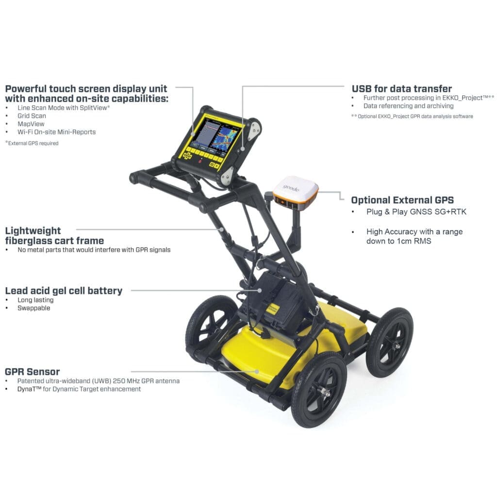
Equipment Breakdown: The LMX200 Advantage
What truly makes the Sensors & Software LMX200 a “game-changer” is the integration of advanced hardware and software features. Unlike entry-level units, the LMX200 is built for the professional who needs to produce reports, not just find a single pipe.
MapView and LineView
The unit features a high-visibility touchscreen that shows both the traditional “LineView” (scrolling radar data) and “MapView” (your GPS path and marked targets). This dual-view capability prevents “lost” data and ensures total site coverage.
Integrated GPS and Wi-Fi
With a high-performance internal GPS, every target you mark is geo-referenced. This data can be exported into GIS software or Google Earth. Furthermore, the built-in Wi-Fi allows you to send screenshots and reports to the project manager before you even leave the site.
Rugged, Non-Metallic Frame
The cart is constructed from high-strength, non-metallic materials. This ensures that the radar signal is not interfered with by the frame of the locator itself, leading to cleaner data and fewer false positives.
Summary and Conclusion
The Sensors & Software LMX200 represents the pinnacle of modern subsurface mapping technology. By combining deep penetration with high-resolution data and automated reporting, it allows Australian contractors to work faster and safer. Whether you are mapping a complex urban intersection or verifying a single gas line, the LMX200 provides the confidence needed to proceed with excavation.
TMG Test Equipment is proud to support the Australian utility industry with the latest GPR solutions and local expertise. By moving beyond legacy electromagnetic methods, your team can uncover what lies beneath with total precision.
Internal Links to Explore
External Resources
Expert Guide Follow-up: Are you planning to use the LMX200 for a specific project type, such as a road upgrade or a utility survey, or would you like more information on the software training we offer?